

Our workstream is a global community of scientists, professionals, volunteers, and students dedicated to the use of satellite-based Earth Observation (EO) for monitoring water quality and quantity.
Earth Observation offers valuable data and insights that can complement in-situ monitoring by providing consistent, large-scale, and long-term observations. These EO-derived data products help us detect changes in water bodies over time, understand spatial patterns, and fill critical data gaps, especially in regions where ground measurements are scarce or unavailable.
By applying EO technologies, we aim to support sustainable water management, contribute to the monitoring and achievement of the Sustainable Development Goals, and drive innovation in addressing global water challenges. EO data can inform early warning systems, track harmful algal blooms, assess sediment and nutrient loads, and monitor surface water extent and dynamics—crucial for ecosystem and human health, agriculture, and climate resilience.
Our activities range from collaborative research and capacity building to knowledge-sharing events. We convene monthly meetings that serve as a space to connect, learn, and share experiences. We welcome newcomers and are actively expanding our network—join us in harnessing EO for a water-secure future.
Highlights
Participatory process for EO-based indicator
Waterbody-level classification using the EO-based indicator
Water-ForCE Roadmap
Workstream publications
Affiliated projects
 The KCL-ACARE Water Quality Monitoring Tool is an interactive, web-based platform that displays satellite-based estimates of key water quality indicators (total suspended solids, Secchi Disk Depth and chlorophyll-a) in seven East African lakes. Using Landsat and Sentinel-2 data, spatial maps and monthly time series are generated for the lake of interest in the selected period with options for download (Note that currently only the Landsat data are available for download). Rainfall and water surface temperature are also available.For more information see: Byrne, A., et al. (2024). LAQUA: a LAndsat water QUality retrieval tool for east African lakes. Remote Sensing 16(16): 2903. https://www.mdpi.com/2072-4292/16/16/2903.Platform team: King’s College London (KCL), African Center for Aquatic Research and Education (ACARE). More information here.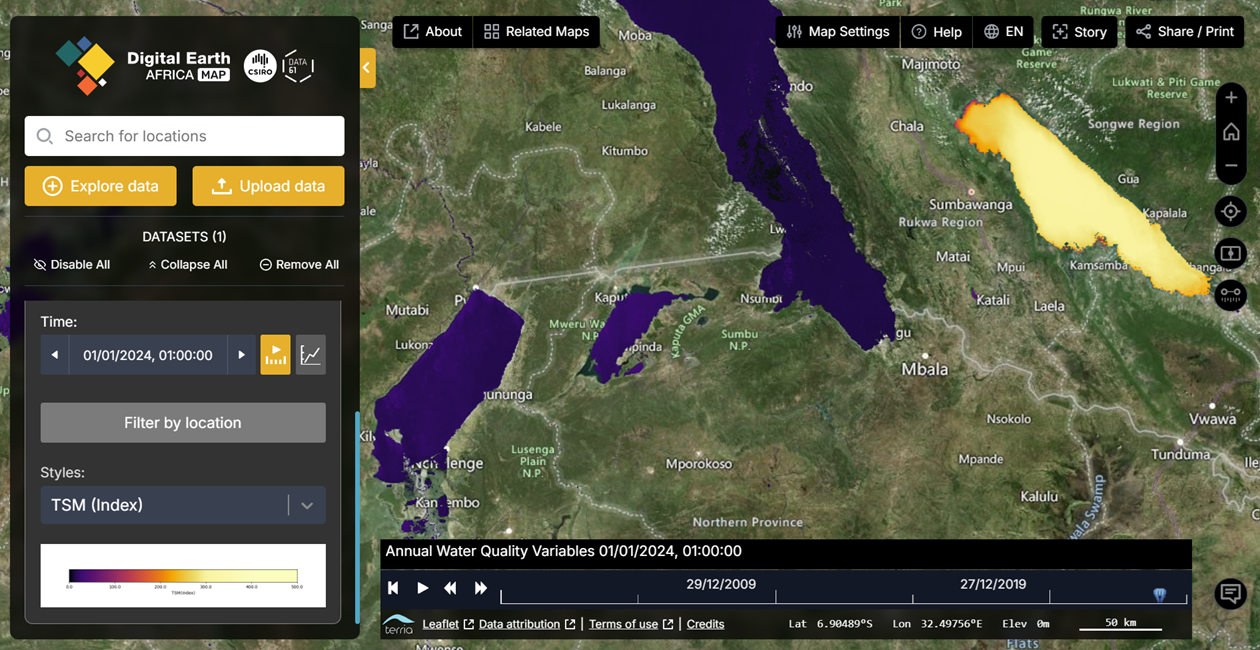
The Digital Earth Africa Map is an interactive visualisation online tool that provides users with the tools to visualise satellite images and access decision-ready data over the African continent, to understand its geographic diversity and how it changes through time. Users can find, visualise and download satellite-based water quality variables at annual intervals, and waterbody historic area extent and surface area time series, amongst other datasets.
To access Digital Earth Africa Map directly: https://maps.digitalearth.africa/
For more information on the Digital Earth Africa initiative: https://digitalearthafrica.org/en_za/
Workstream events
No event scheduled
Questions about the workstream or you would like to be a member of the workstream, let us know by clicking on the button.
Collaborating partners

University of Stirling

Brockmann Consult